
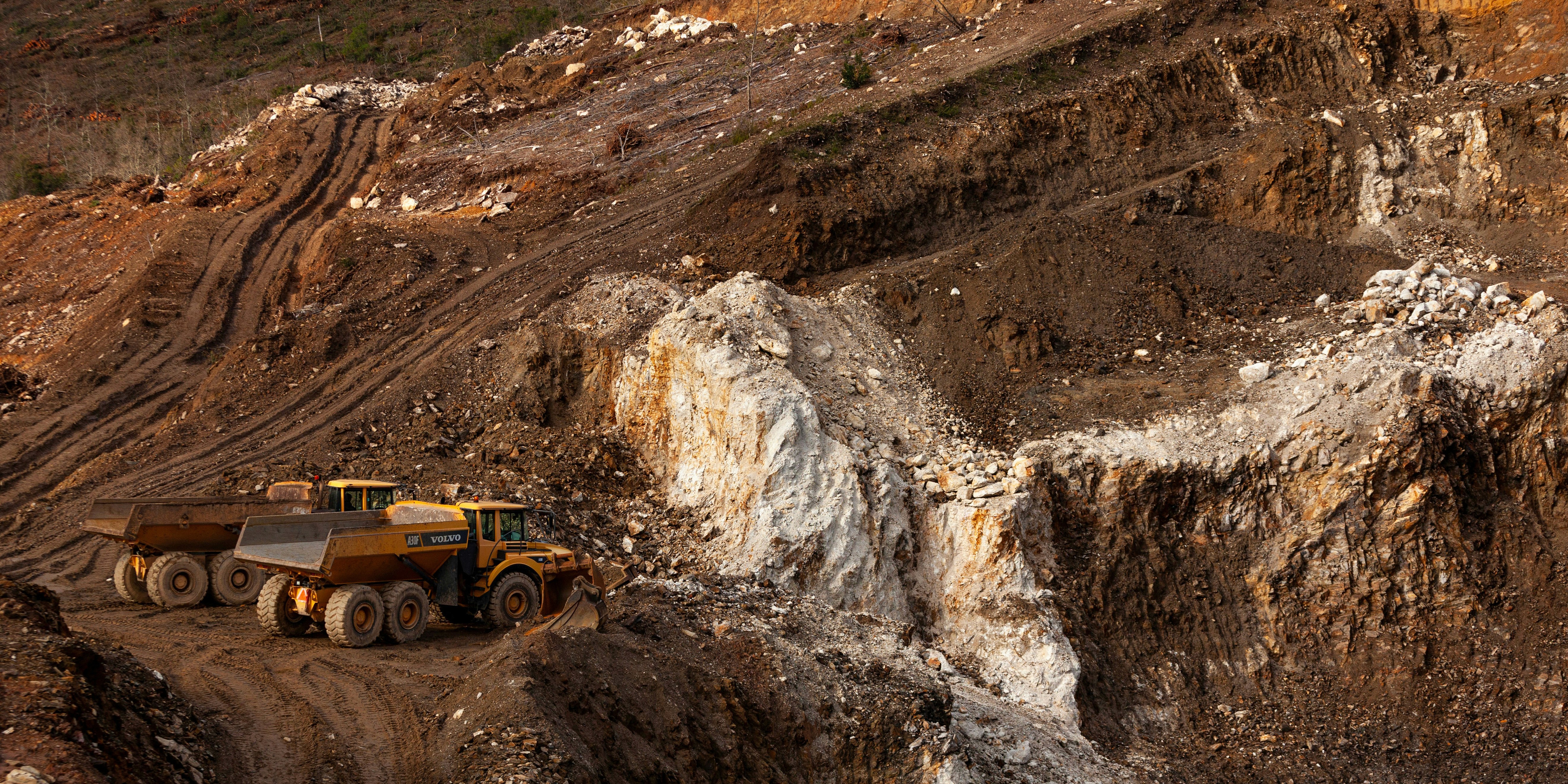
Accurate Stockpile & Earthwork Measurements Without a Crew
Sky Grid Imaging's drone-based volumetric analysis offers fast, cost-effective measurement of material piles, cut/fill operations, and land movement — no ground teams or guesswork required.
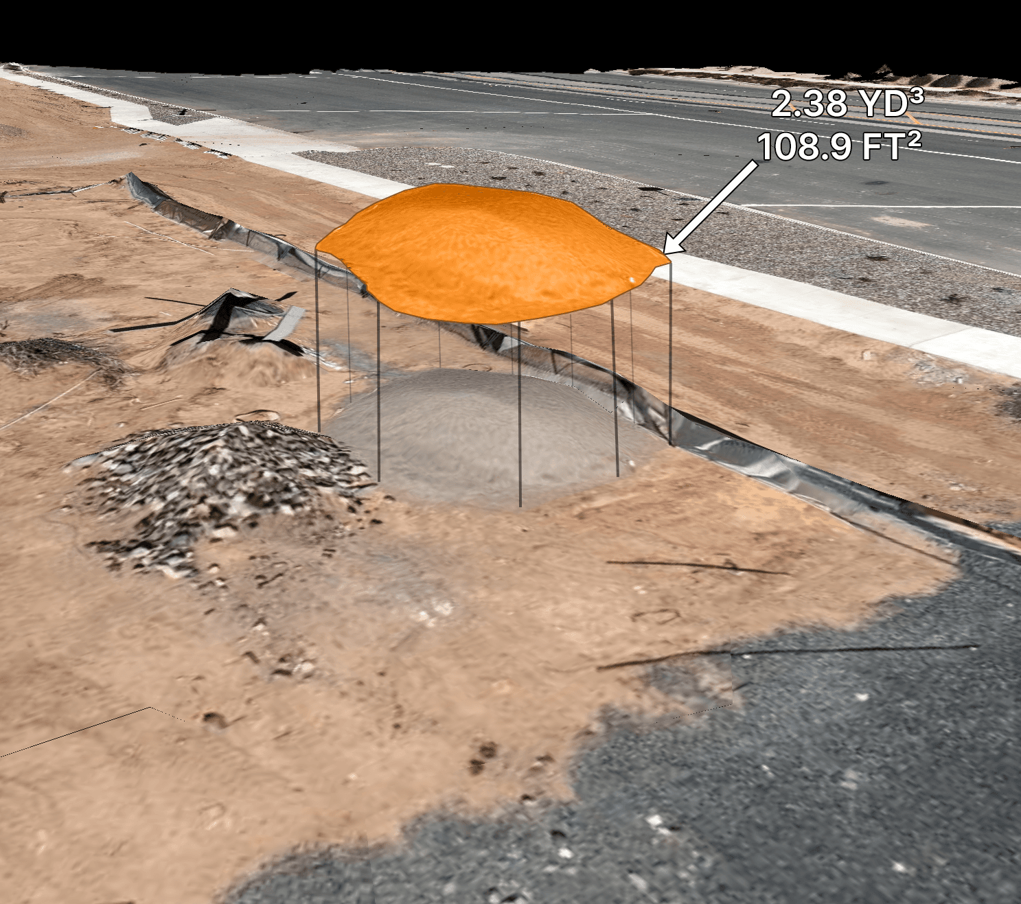
Stockpile Measurements
Replace estimates with audit-ready numbers tied to visuals. Track inventory over time and plan purchases precisely.
Benefits:
Reduce write-offs and over-ordering
Time-series tracking for audits
Simple exports for reporting
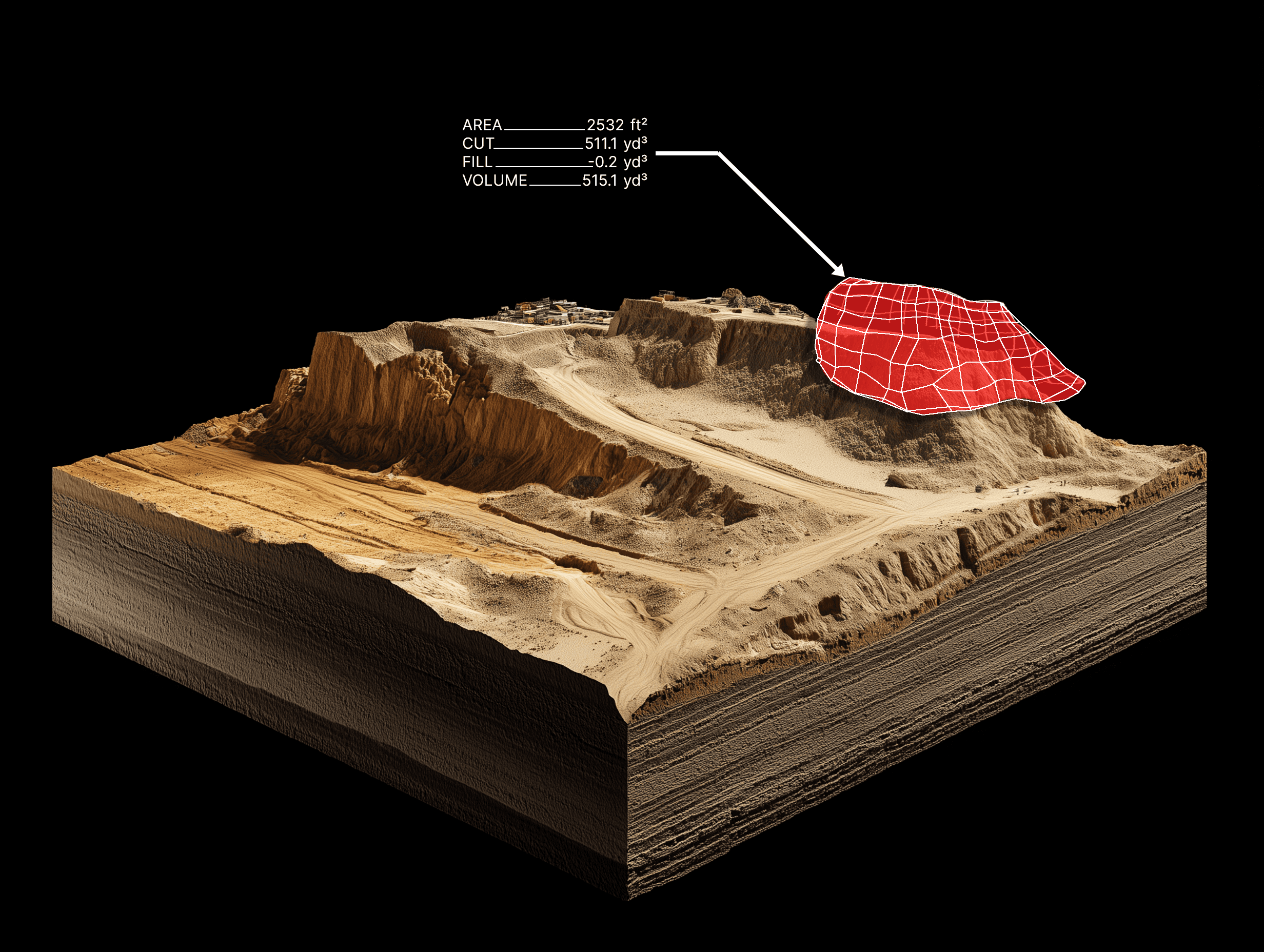
Cut & Fill Analysis
Verify quantities moved and compare against plans. Optimize hauling and avoid costly over/under-cuts.
Benefits:
Quantities you can defend
Better logistics and scheduling
Lower rework costs
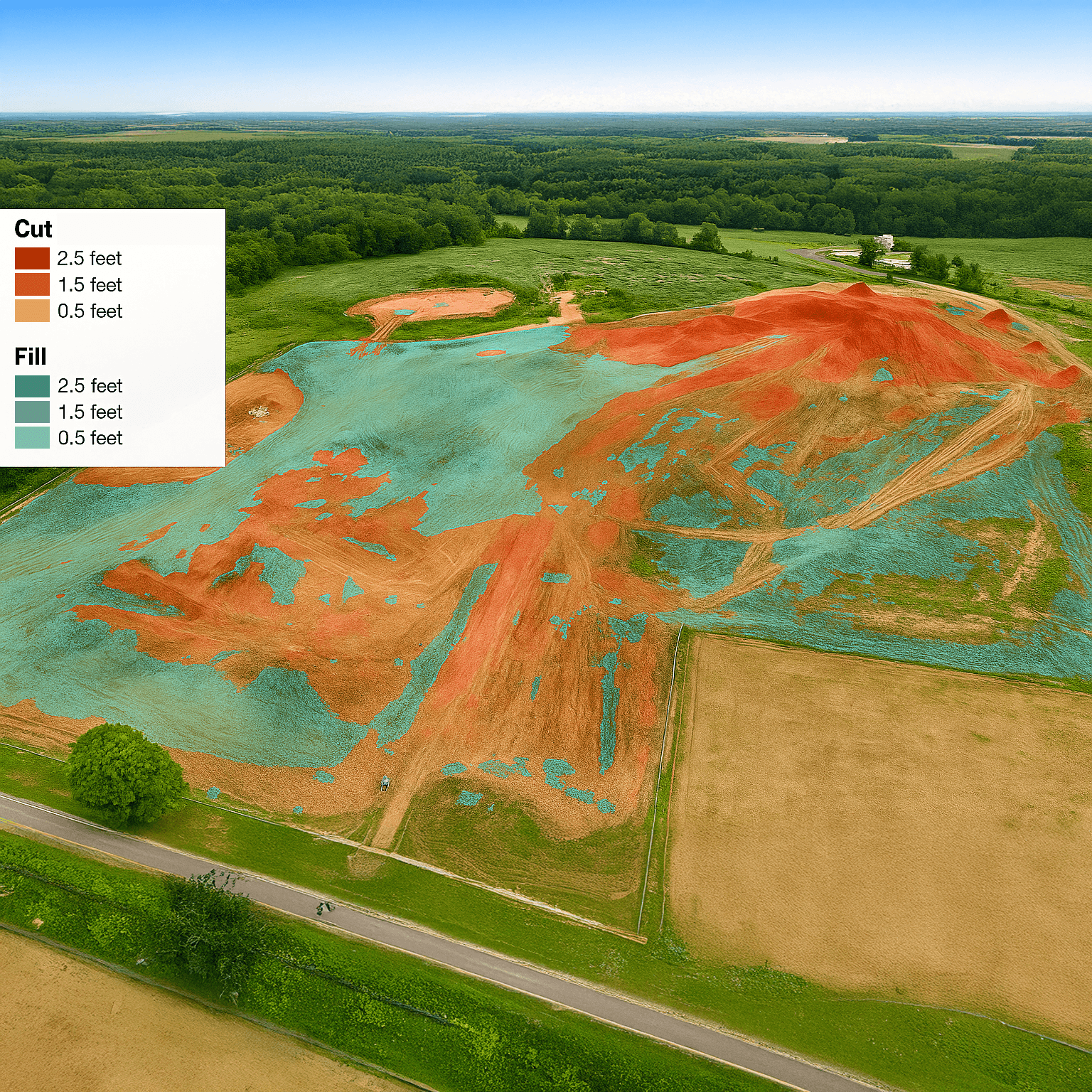
Site Balancing & Phase Planning
Use accurate terrain models to plan balanced grades. Align crews with realistic targets for each phase.
Benefits:
Smarter staging and sequencing
Fewer surprises in the field
Clear visuals for team briefings
Compliance & Audit Support
Deliverables include visuals, contours, and method notes. Share with regulators, clients, and finance confidently.
Benefits:
Easier compliance reporting
Strong backing for invoices
Reduced disputes